Kawerau road conditions are primarily determined by traffic on State Highway 34 and the heavy industrial presence of logging trucks. Drivers must remain vigilant for frequent forestry vehicle movements, seasonal fog hazards in the morning, and access restrictions on private forestry roads leading to attractions like Tarawera Falls, which require permits.
Located in the heart of the Bay of Plenty, Kawerau serves as a vital industrial hub and a strategic gateway to Free Things to Do in Kawerau for Families. Whether you are commuting for work, visiting friends, or using the town as a base camp for exploring the wider Whakatāne and Rotorua districts, understanding the local road environment is critical for safety. For those considering a move or extended stay, understanding local infrastructure is key to the Relocation & Digital Nomad Lifestyle.
Real-Time Road Closure Updates
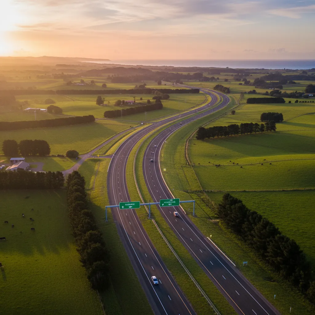
Staying informed about the dynamic nature of New Zealand’s road network is the first step in any safe journey. In the Eastern Bay of Plenty, road conditions can change rapidly due to maintenance, accidents, or weather events. The primary artery into town is State Highway 34 (SH34), which connects with State Highway 30 (SH30).
Where to Check Official Status
Before departing, it is imperative to consult official sources. Waka Kotahi NZ Transport Agency provides the most accurate, real-time data regarding state highways. For local roads within the township and immediate surroundings, the Kawerau District Council (refer to the Kawerau Essential Services & Amenities) and Whakatāne District Council websites offer updates on scheduled maintenance and unexpected closures.
Key Monitoring Tools:
- Waka Kotahi Journey Planner: Offers a live map view of roadworks, closures, and webcams.
- AA Traveller: Provides independent reporting on traffic flow and incidents.
- Local Radio Stations: 1XX (90.5 FM) and Sun FM often broadcast immediate local traffic alerts that may not yet appear on national apps.
Common Roadwork Areas
Travelers should expect periodic delays on SH34 between the SH30 intersection and the Kawerau township. This stretch often undergoes resurfacing due to the high volume of heavy industrial traffic it sustains. Additionally, the route towards Rotorua via SH30 often has maintenance crews operating near the Rotoma hills. Always adhere to temporary speed limits; they are enforced to protect road workers and prevent windshield damage from loose chip seal.
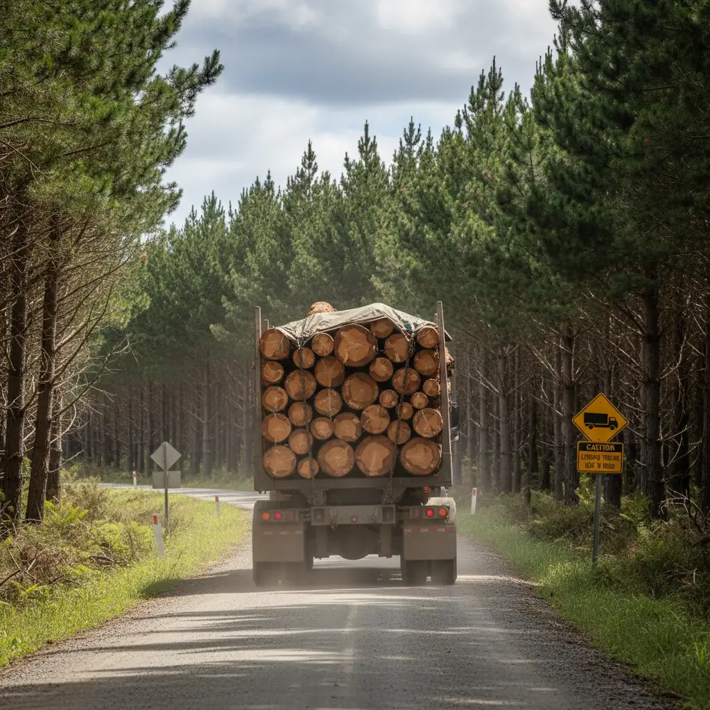
Navigating Heavy Vehicle Traffic
Kawerau is synonymous with the forestry industry. It is home to major pulp and paper mills, timber processing plants, and the Waterhouse Street Industrial Park. Consequently, the density of heavy commercial vehicles (HCVs)—specifically logging trucks—is significantly higher here than in typical New Zealand towns.
Sharing the Road with Logging Trucks
Driving alongside fully loaded logging trucks requires patience and specific defensive driving techniques. These vehicles are long, heavy, and require substantial stopping distances. When navigating the roundabouts entering Kawerau or the intersections along SH34, give these vehicles ample space.
Critical Safety Rules:
- Blind Spots: If you cannot see the truck driver’s mirrors, they cannot see you. Avoid lingering alongside a truck; pass quickly and safely when the road is clear, or stay well back.
- Turning Radius: Logging trucks often need to swing wide to negotiate turns. Never attempt to undertake a truck on the left at an intersection or roundabout, as the trailer may cut in, closing the gap.
- Following Distance: Increase your following distance to at least four seconds. This improves your visibility of the road ahead and prevents stone chips from the truck’s tires damaging your vehicle.
The “un-laden” Risk
It is a common misconception that empty trucks are safer. Un-laden logging trucks are lighter and may be more susceptible to crosswinds. Furthermore, they may bounce more on uneven surfaces. Treat empty trucks with the same respect as fully loaded ones.
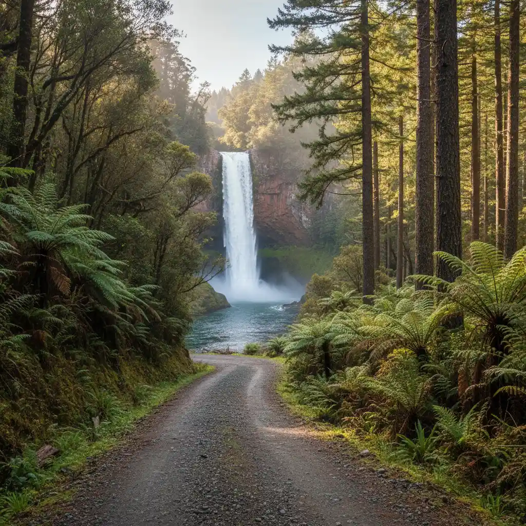
Forestry Road Access and Rules
One of the unique aspects of Kawerau road conditions is the transition from public highways to private forestry roads. Many of the region’s premier attractions, such as the spectacular Tarawera Falls and Lake Tarawera outlet, are located behind controlled access gates within the commercial forest estate.
Understanding the Permit System
You cannot simply drive into the forest. These roads are active industrial worksites. Access is strictly controlled to ensure the safety of the public and forestry workers. To drive on these private roads, you generally need a permit. Many local businesses, including those related to Industrial Training Programs, operate closely with these managed zones.
How to obtain access:
- Tarawera Falls: Access permits are usually available from the Kawerau i-SITE Visitor Information Centre on Plunket Street. There is a nominal fee which contributes to road maintenance.
- Online Systems: Some forestry managers are moving to online permit systems. Always check the latest requirements on the Kawerau i-SITE website before planning your trip.
- Gate Closures: Forestry roads are often closed during hours of darkness, periods of high fire risk, or during intensive logging operations. Ignoring these closures is trespassing and extremely dangerous.
Driving on Unsealed Forestry Roads
Once you pass the gate, the road conditions change legally and physically. These are private roads, but standard New Zealand road rules still apply. However, the physical environment is more challenging.
Gravel Driving Tips:
- Reduce Speed: The speed limit is often lower than the open road (usually 50km/h or less). Gravel offers significantly less traction than tarmac.
- Headlights On: Visibility can be reduced by dust. Keep your headlights on low beam at all times to ensure you are seen by oncoming logging trucks.
- Keep Left: Forestry roads can be narrow. Always keep as far left as safely possible, especially on blind corners.
- Dust Management: If following another vehicle, the dust cloud can be blinding. Drop back until visibility improves.
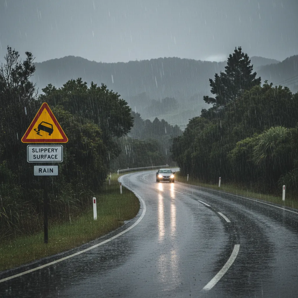
Seasonal Weather Hazards
The geography of the Kawerau district, situated in a valley near the Tarawera River and Mount Putauaki, creates specific micro-climates that impact road conditions.
Winter Fog and Ice
During the winter months (June to August), Kawerau is prone to dense fog, particularly in the early morning. This can reduce visibility to less than 50 meters on SH34 and local roads. Black ice is less common than in the central high country but can occur on shaded corners and bridges on cold mornings.
Advice for Fog Driving:
- Use fog lights if available, but avoid high beams which reflect off the fog and worsen visibility.
- Increase following distances significantly.
- Use the left-hand road markings as a guide.
Heavy Rain and Slips
The Bay of Plenty can experience intense subtropical rain events. This can lead to surface flooding on low-lying roads and slips on the hillier sections connecting Kawerau to the Rotoma and Rotoiti lakes. After heavy rain, be prepared for debris on the road, including tree branches and rocks.
Strategic Routes: The Base Camp Advantage
Despite the industrial traffic, Kawerau’s central location makes it an excellent “Base Camp” for tourists. The road network allows for easy day trips to Rotorua (45 minutes), Whakatāne (30 minutes), and Tauranga (1 hour 15 minutes). Understanding the condition of these connecting routes enhances the visitor experience.
Route to Rotorua (SH30)
This route takes you past the beautiful Rotoma and Rotoiti lakes. The road is winding and scenic. Road conditions here are generally good, but passing lanes are limited. Patience is required, especially during summer when campervan traffic increases.
Route to Whakatāne (SH30)
A largely flat and straight run across the Rangitāiki Plains. This road is fast but can be impacted by crosswinds. It is a major agricultural transport route, so expect milk tankers and tractors alongside logging units.
Emergency Contact Numbers & Resources
In the event of an accident, breakdown, or road hazard, having the right contact information is vital. Cell phone coverage is generally good in Kawerau and along the state highways but can be spotty within the Tarawera Forest. For those traveling in electric vehicles, knowing where to charge is also important, check out the Kawerau EV Charging Stations: Locations & Speed.
- Emergency (Police, Fire, Ambulance): Dial 111
- Traffic Incidents (Non-Emergency): *555 (from a mobile)
- Kawerau i-SITE Visitor Centre: +64 7 323 6300 (For permit and local road inquiries)
- Whakatāne District Council (24/7 Service): +64 7 306 0500
Vehicle Preparation Checklist:
- Ensure your spare tire is inflated and you have a working jack.
- Carry a first aid kit and a torch.
- Keep a physical map in the car, as GPS signals can drop in forestry blocks.
People Also Ask
Is the road to Tarawera Falls sealed?
No, the road to Tarawera Falls is primarily unsealed gravel. It is a private forestry road that requires a permit to access. While it is generally maintained to a standard suitable for standard cars, drivers should proceed with caution, keeping headlights on and watching for potholes and logging trucks.
Do I need a permit to drive in Kawerau forests?
Yes, access to the private forestry roads surrounding Kawerau, including those leading to Tarawera Falls, requires a permit. These can be purchased from the Kawerau i-SITE Visitor Information Centre. Unauthorized access is considered trespassing and is dangerous due to active logging operations.
Are there logging trucks on weekends in Kawerau?
Yes, the forestry industry operates 24/7 in many capacities. While traffic volume may be slightly lower on weekends compared to weekdays, you should always expect to encounter logging trucks on State Highway 34 and surrounding forestry roads at any time of the week.
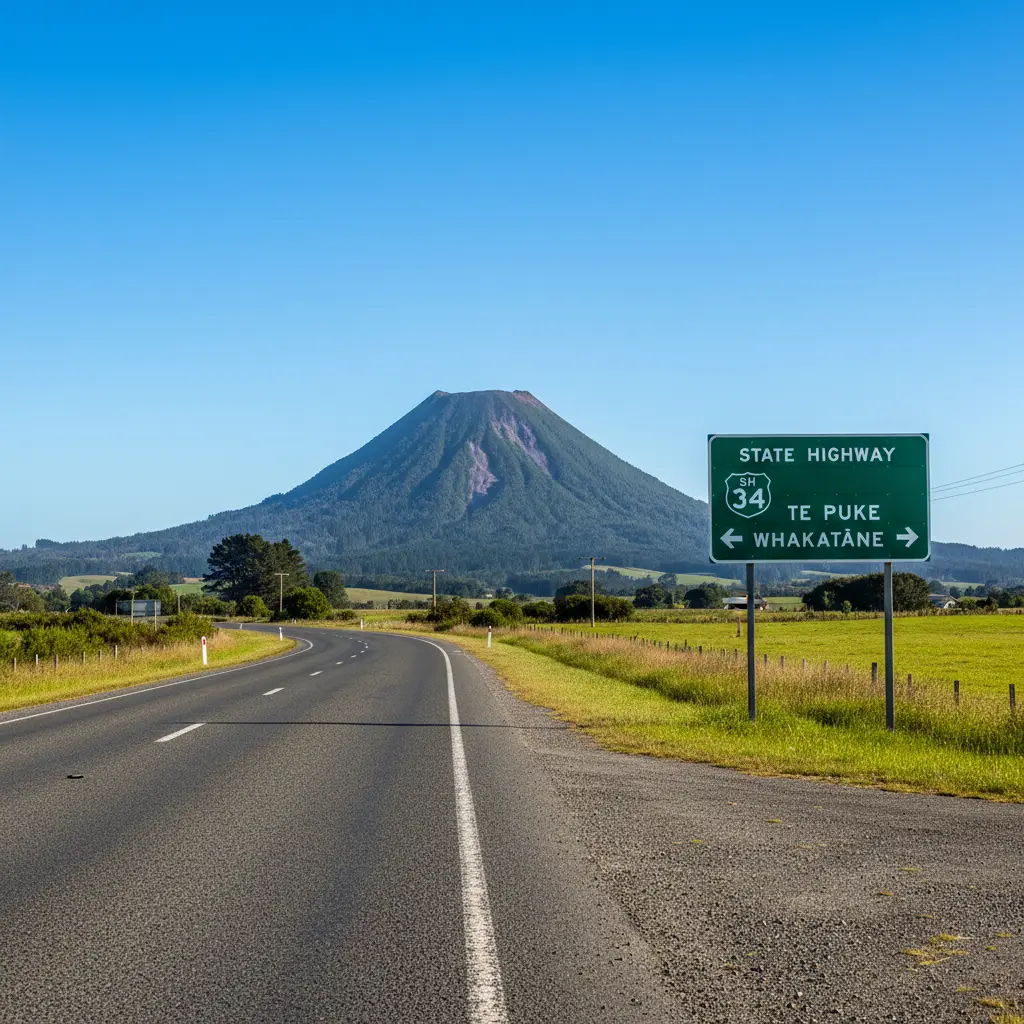
What is the main road into Kawerau?
The main access road into Kawerau is State Highway 34 (SH34). It branches off State Highway 30 near Teko and runs directly through to the township. It is a sealed, two-lane highway heavily utilized by industrial traffic.
How far is Kawerau from Rotorua by car?
Kawerau is approximately a 45 to 50-minute drive from Rotorua (about 55km) via State Highway 30. The drive is scenic, passing by Lake Rotoma and Lake Rotoiti, but the road can be winding in sections.
Is it safe to drive in Kawerau at night?
Yes, it is generally safe to drive in Kawerau at night. However, drivers should be aware of reduced visibility due to potential fog in winter and the presence of heavy trucks. Ensure your vehicle’s lighting system is fully functional and drive to the conditions.