Weather safety in Kawerau requires preparation for the Bay of Plenty’s variable microclimates. Hikers must monitor MetService forecasts for rapid changes, carry layers to prevent hypothermia on exposed peaks like Putauaki, apply high-SPF sunscreen against intense UV radiation, and avoid river crossings during heavy rainfall to prevent flash flooding accidents.
What makes weather safety in Kawerau unique?
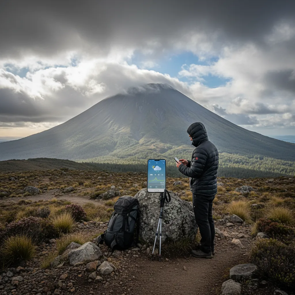
Kawerau serves as a pivotal gateway to the Whakatāne District’s rugged backcountry, positioned uniquely between the coastal plains and the volcanic plateau. This geographic positioning creates a distinct microclimate that can deceive even experienced outdoor enthusiasts. While the town itself sits in a sheltered valley, the surrounding peaks—most notably Putauaki (Mt Edgecumbe)—and the Tarawera River catchment experience weather patterns that are significantly more volatile.
Effective weather safety in Kawerau begins with acknowledging that conditions at the trailhead often bear little resemblance to conditions at the summit or deep within the Tarawera Forest. The region is subject to the “orographic effect,” where moist air is lifted over the mountain ranges, cooling and condensing to form clouds and precipitation rapidly. This means a sunny morning in the township can transform into a torrential downpour with gale-force winds at higher elevations within hours.
How to manage sun safety and heat exhaustion?
New Zealand’s sun is notoriously harsh due to the thinner ozone layer above the region, and Kawerau is no exception. During the peak tourism months of December through February, the Ultraviolet (UV) Index frequently exceeds 11, which is categorized as “Extreme.” For hikers exploring the Tarawera Falls track or ascending local peaks, sun safety is not merely about comfort; it is a critical health requirement.
Understanding Burn Times
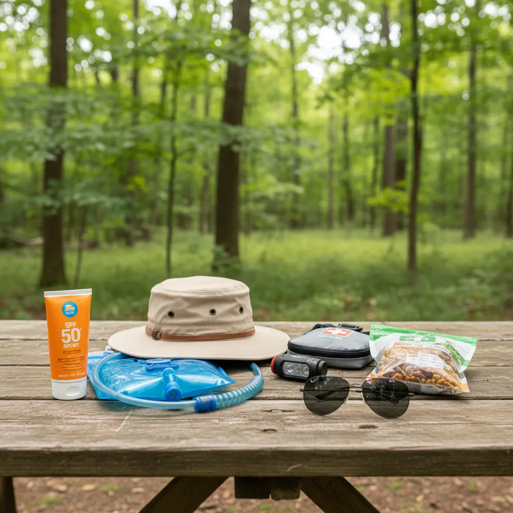
In Kawerau’s summer, skin damage can occur in as little as 10 to 15 minutes. The air temperature may feel moderate due to coastal breezes funneling down the valley, but this often masks the intensity of the solar radiation. Hikers must adopt a “slip, slop, slap, and wrap” approach: slip on long-sleeved clothing, slop on broad-spectrum SPF 50+ sunscreen, slap on a wide-brimmed hat, and wrap on high-quality sunglasses.
Hydration Strategies for the Tarawera Forest
Heat exhaustion is a prevalent risk when trekking in the dense, humidity-trapping bush of the Tarawera Forest. The canopy reduces airflow, creating a sauna-like environment. Visitors should carry a minimum of 3 liters of water per person for day hikes. Unlike the alpine streams in the South Island, water sources in lower-elevation geothermal areas may not always be potable without treatment due to mineral content or biological factors. Always carry purification tablets or a filter system as a backup.
What are the hypothermia risks in Kawerau’s winter?
While the Bay of Plenty is often marketed as the “Winterless North,” this moniker can lead to a dangerous sense of complacency among hikers. Winter in Kawerau (June to August) brings temperatures that can drop near freezing, particularly at dawn and dusk. However, the primary danger is not the ambient temperature alone, but the combination of wind, rain, and exposure—the “unholy trinity” that leads to hypothermia.
The Danger of Cotton
A fundamental rule of weather safety in Kawerau is to avoid cotton clothing entirely. When cotton gets wet—whether from rain or sweat—it loses its insulating properties and saps body heat 25 times faster than air. Given the likelihood of sudden showers in the region, hikers should utilize a layering system consisting of merino wool or synthetic base layers, an insulating fleece mid-layer, and a waterproof, windproof hard shell.
Summit Exposure on Putauaki
Climbing Putauaki offers spectacular views, but the summit is fully exposed to prevailing winds. Wind chill can reduce the effective temperature by 5 to 10 degrees Celsius. Hypothermia affects cognitive function first; hikers may become confused, lethargic, or clumsy before they feel cold. If any member of a hiking party begins to shiver uncontrollably or slur their speech, immediate action is required: seek shelter, change into dry clothes, and consume high-energy food.
How to stay safe around rivers during heavy rain?
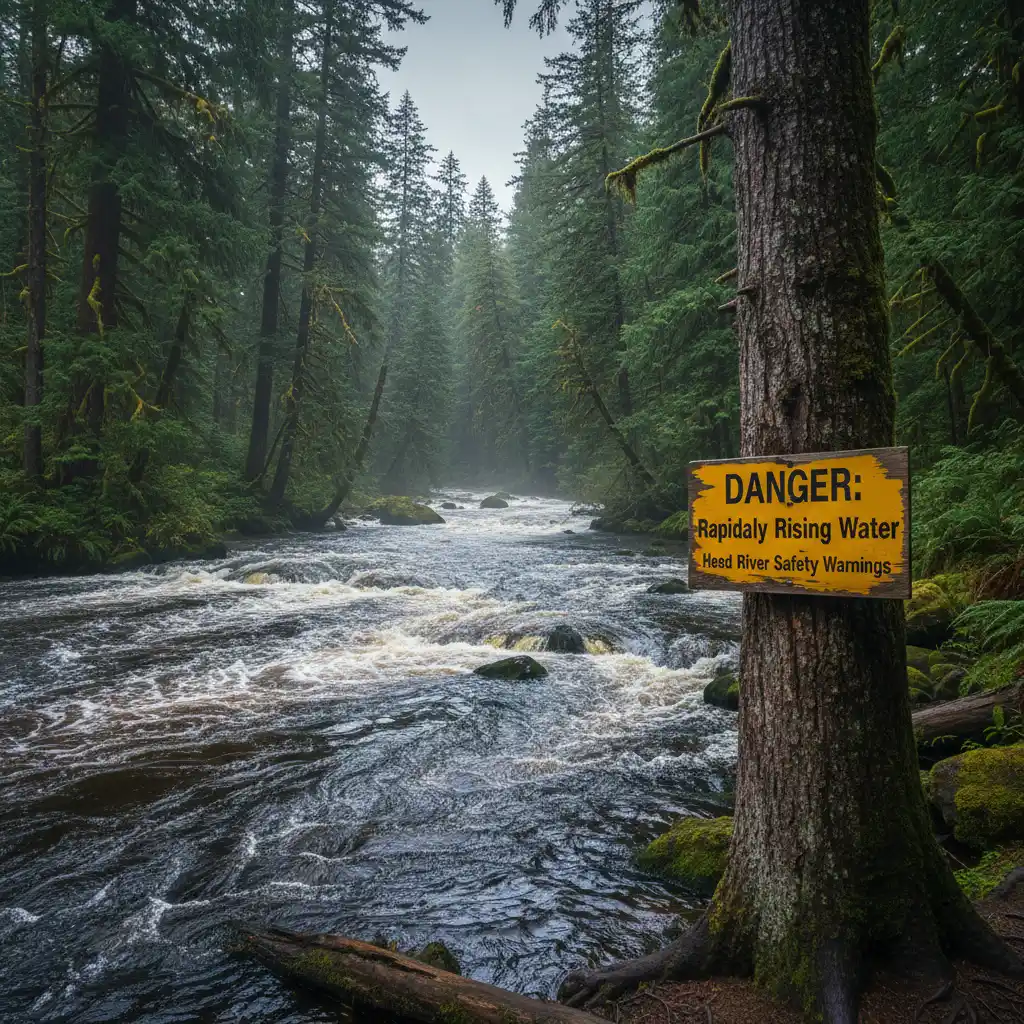
The Tarawera River is a powerful watercourse that demands respect. Fed by Lake Tarawera and numerous tributaries, the river levels can rise unexpectedly fast during and after heavy rainfall events. This phenomenon, known as flash flooding, poses a severe risk to anglers, kayakers, and hikers attempting river crossings.
Identifying River Hazards
Before attempting any track that involves a river crossing or walking near the riverbank, check the recent rainfall data for the entire catchment area, not just Kawerau township. Rain falling high in the ranges takes time to flow down, meaning water levels can rise under blue skies. Signs of a rising river include discolored (brown or muddy) water, debris floating downstream, and the sound of rolling stones on the riverbed.
The “If in Doubt, Stay Out” Rule
The New Zealand Mountain Safety Council promotes a simple yet vital rule: if you are unsure about a crossing, do not attempt it. In the context of Kawerau’s geography, many tracks have bridges. However, off-track exploration or older tracks may require fording. Never cross a river that is flowing faster than walking pace or is deeper than knee-height. If caught on the wrong side of a rising river, the safest strategy is to wait it out. River levels in this region often drop as quickly as they rise once the rain ceases.
Where are the emergency shelter locations?
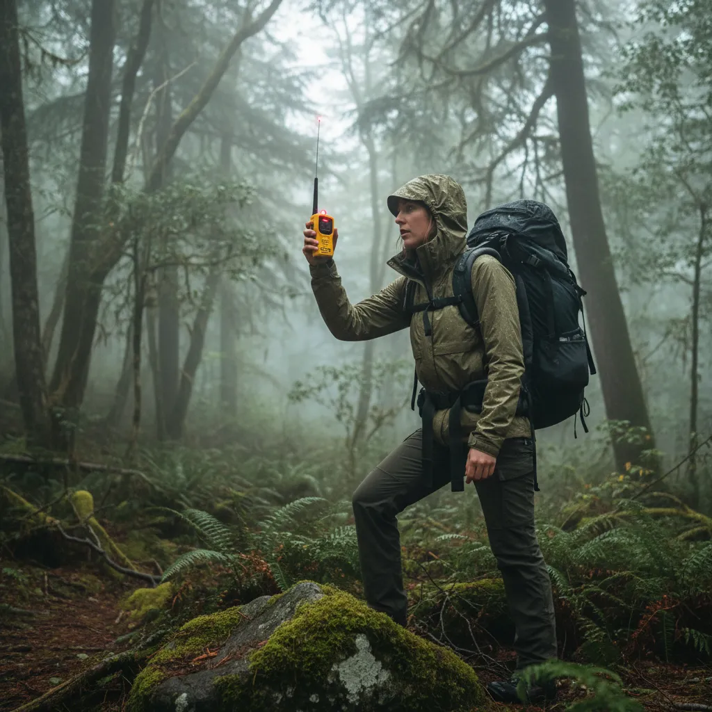
Preparation for the unexpected is the hallmark of a professional adventurer. In the event of severe weather incapacitation or injury, knowing where to find shelter and how to communicate is paramount. The Kawerau region has specific zones where cell reception is notoriously poor, particularly deep within the Tarawera Forest and behind the volcanic cones.
Shelter Options vs. Self-Reliance
Unlike some of New Zealand’s Great Walks, the tracks immediately surrounding Kawerau do not feature a dense network of Department of Conservation (DOC) huts. Therefore, day hikers must carry an emergency shelter. This does not necessarily mean a tent; a lightweight bothy bag or a thermal emergency bivvy sack can be a lifesaver. These items trap body heat and provide a microclimate that protects against wind and rain while waiting for rescue.
Communication in Dead Zones
Relying solely on a mobile phone is a critical error in backcountry safety planning. While 4G coverage is available in the town and on high peaks, the valleys are often dead zones. For serious excursions, carrying a Personal Locator Beacon (PLB) is strongly recommended. A PLB transmits a distress signal directly to the Rescue Coordination Centre via satellite, pinpointing your location regardless of cell tower range. These can often be rented from local i-SITE visitor centers or outdoor equipment stores.
Why is the “Kawerau Base Camp Strategy” effective?
For tourists and domestic travelers, adopting a “Base Camp Strategy” is the smartest way to manage weather risks. By establishing accommodation in Kawerau, adventurers gain the flexibility to alter their itinerary based on real-time weather reports. If the forecast predicts gale-force winds on the peaks, the itinerary can be pivoted to low-level forest walks or enjoying the geothermal assets of the region.
This strategy minimizes the pressure to “push on” into dangerous conditions simply because a hut booking must be met. It allows for a safety-first approach where decisions are made based on current conditions rather than logistical constraints. Furthermore, Kawerau offers amenities such as hot pools which act as excellent recovery tools for hikers who have battled the elements, warming the core temperature and relaxing fatigued muscles.
Final Thoughts on Weather Preparedness
Navigating the outdoors in the Bay of Plenty is a rewarding experience, provided that weather safety is prioritized. By respecting the sun, preparing for cold snaps, exercising caution around rivers, and carrying the correct emergency equipment, visitors can safely enjoy the stunning landscapes Kawerau has to offer. Remember, the mountain will always be there; the goal is to ensure you are there to climb it another day.
What is the best time of year to hike in Kawerau?
The shoulder seasons (late spring and early autumn) are generally considered the best times to hike. February to April offers stable weather with cooler temperatures than the peak of summer, reducing the risk of heat exhaustion while maintaining long daylight hours.
Do I need a permit to hike in Tarawera Forest?
Yes, access permits are often required for the Tarawera Forest as it is privately owned land managed for forestry. These can be obtained from the Kawerau i-SITE Visitor Information Centre. Always check the current access status before departing.
Is the water in Kawerau streams safe to drink?
It is generally recommended to treat all water collected from streams and rivers in the Kawerau region. Giardia and other pathogens can be present, and geothermal activity can affect water chemistry. Boiling, filtering, or using chemical tabs is advised.
What gear is essential for a day hike in Kawerau?
Essential gear includes a waterproof jacket, sturdy hiking boots, a first aid kit, 2-3 liters of water, sun protection (hat, sunglasses, sunscreen), a thermal layer (polypropylene or wool), a map/compass or GPS, and a fully charged mobile phone.
Are there guided hiking tours available in Kawerau?
Yes, there are local cultural and hiking guides available who can provide safe passage and historical context, particularly for significant sites like Mount Putauaki. Utilizing a guide is excellent for weather safety as they are familiar with local microclimates.
What should I do if I see a fire in the forest?
If you spot smoke or fire in the Tarawera Forest or surrounding bush, evacuate the area immediately and dial 111 to report the fire to emergency services. Do not attempt to investigate; fire spreads rapidly in forestry blocks, especially during dry summers.