Driving from Rotorua to Kawerau takes approximately 45 to 55 minutes, covering a distance of about 55 kilometers via State Highway 30. This scenic route winds past Lakes Rotoiti, Rotoehu, and Rotomā. Motorists should exercise caution due to winding roads and frequent logging truck traffic common in the Bay of Plenty region.
Located in the heart of the Bay of Plenty, the journey between the geothermal tourism hub of Rotorua and the industrial, adventure-ready town of Kawerau is a staple of North Island travel. While the distance is relatively short, the drive offers a microcosm of New Zealand’s diverse landscape—transitioning from bustling tourist centers, through native bush and serene lakes, to the powerhouse of the timber industry under the shadow of Mount Putauaki.
Whether you are visiting for the Tarawera River whitewater, business at the mill, or utilizing Kawerau as a strategic “base camp” for exploring the wider Eastern Bay of Plenty, understanding the nuances of this route is essential for a safe journey.
What is the Best Route from Rotorua to Kawerau?
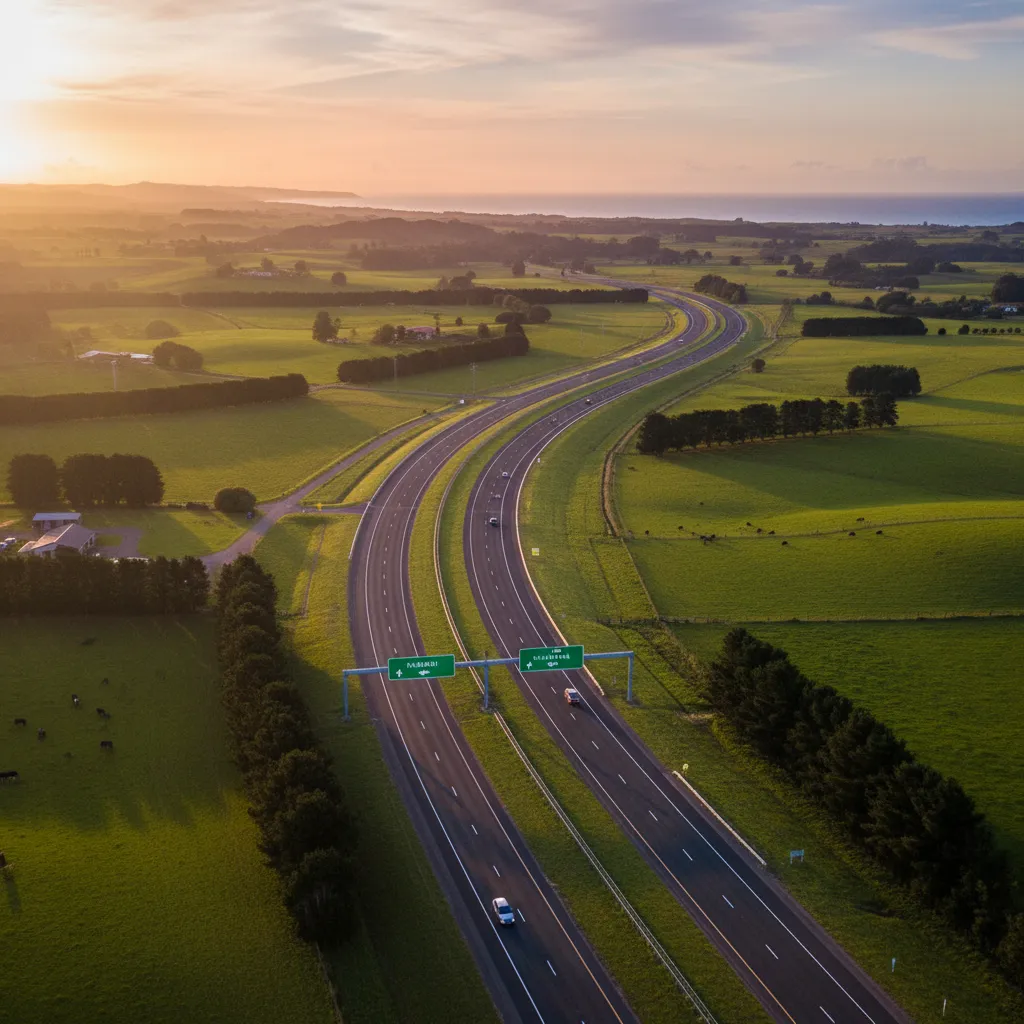
The primary and most efficient route for driving from Rotorua to Kawerau is via State Highway 30 (SH30). This direct corridor runs east from Rotorua, skirting the northern edge of the Rotorua lakes district before descending towards the Rangitāiki Plains.
Time and Distance Breakdown
Under normal traffic conditions, the drive is highly predictable:
- Distance: Approximately 55 to 58 kilometers (depending on your start point in Rotorua).
- Time: 45 to 55 minutes.
- Traffic Impact: Traffic is generally fluid, though peak commute times (7:00 AM – 8:30 AM and 4:00 PM – 5:30 PM) can add 10-15 minutes, particularly exiting Rotorua past the airport.
While navigation apps might occasionally suggest a northern route via SH33 and SH2 (turning off at Paengaroa), this is significantly longer in both distance and time. Unless there is a major road closure on SH30 or you intend to visit the coast first, stick to the inland SH30 route.

What are the Road Conditions on SH30?
State Highway 30 is a fully sealed, two-lane highway (one lane in each direction) with occasional passing lanes. The road quality is generally high, maintained by Waka Kotahi NZ Transport Agency, but the geography presents specific challenges that drivers must respect.
The “Rotomā Hills” Section
The most technical part of driving from Rotorua to Kawerau involves the section past Lake Rotomā. As you leave the lake district and descend toward the plains, the road becomes sinuous. These curves are well-cambered, but they require a reduction in speed. The descent includes several tight corners that can catch inexperienced drivers off guard, particularly if the road surface is wet.
Road Surface and Maintenance
Because this route serves as a major arterial line for the forestry industry, the road surface undergoes significant stress. While generally smooth, you may encounter areas of “chip seal” repair. If you see temporary speed limit signs indicating loose stones (usually 30km/h), adhere to them strictly to avoid cracked windshields from flying gravel.
Where are the Best Scenic Stops?
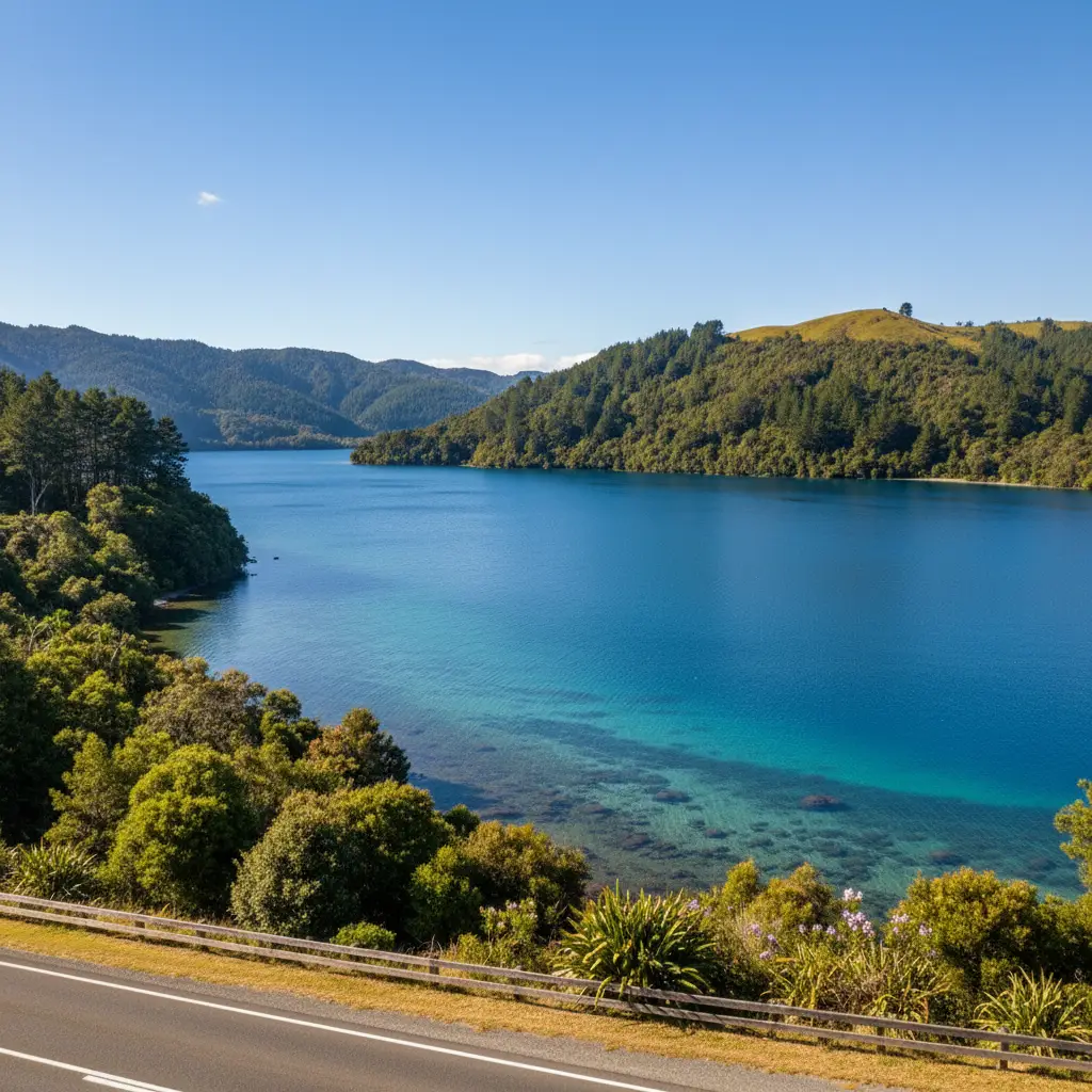
One of the major benefits of driving from Rotorua to Kawerau is the incredible scenery. The route takes you through the “Rotoma-Rotoiti” gap, offering stunning lakeside views that are perfect for breaking up the journey.
1. Hinehopu / Hongi’s Track
Located between Lake Rotoiti and Lake Rotoehu, this is a historically significant site. A short pull-off allows you to see the famous “Wishing Tree” (a native tree deemed sacred). It is an excellent spot to stretch your legs for 5 minutes under the canopy of ancient native bush.
2. Lake Rotomā Laybys
Lake Rotomā is renowned for having some of the clearest freshwater in the Bay of Plenty. As you drive along SH30, there are several designated laybys and picnic areas on the left-hand side (heading towards Kawerau). These spots offer unobstructed views of the lake. On a calm day, the reflection of the surrounding hills on the water is mirror-perfect.
3. The Soda Springs
Just past Lake Rotomā, near the turnoff to SH30’s descent, there are natural soda springs. While less developed than commercial spas, they are a local landmark indicating you are leaving the volcanic plateau and entering the forestry basin.
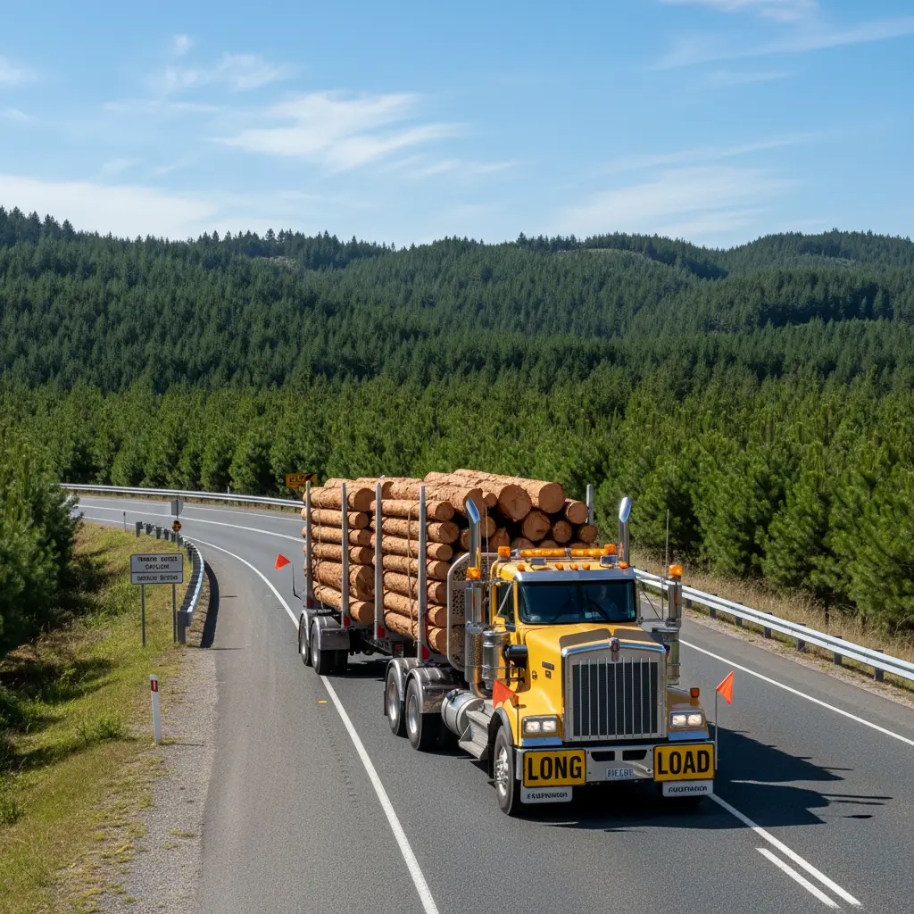
How to Drive Safely Around Logging Trucks
This is the single most important safety consideration when driving from Rotorua to Kawerau. Kawerau is a purpose-built industrial town, home to massive pulp and paper mills and sawmills. Consequently, SH30 is a heavy haulage route.
You will inevitably share the road with large logging trucks. Understanding their limitations is key to your safety:
- Passing Limitations: These trucks are heavy and slow down significantly on uphill gradients (such as the climb out of Tikitere or the Rotomā hills). However, they pick up significant momentum on downhills. Only pass when there is a clear, long passing lane. Never attempt to overtake a logging truck on a double yellow line or near a corner.
- Following Distance: Increase your following distance to at least 3 or 4 seconds. If you are too close, the truck driver cannot see you in their mirrors. Furthermore, logging trucks can kick up spray during rain or debris/stones on dry days.
- Wide Turns: If you encounter a truck turning into a forestry road or at an intersection in Kawerau, hold back. They often need to swing wide into the opposing lane to complete a turn.
What are the Winter Driving Precautions?
While the Bay of Plenty has a temperate climate, the inland route between Rotorua and Kawerau has specific winter micro-climates that drivers must prepare for between May and August.
Black Ice Risks
The area around Hongi’s Track and the shaded sections of the Rotomā hills are notorious for black ice. Because the road is surrounded by dense bush, the sun often doesn’t hit the tarmac until late morning. If you are driving early in the morning (before 9:00 AM) during winter, assume the corners are slippery even if they look dry.
Fog and Visibility
The lakes (Rotoiti, Rotoehu, Rotomā) generate significant fog banks in the winter. You might leave a sunny Rotorua and descend into a “pea soup” fog around the lakes, reducing visibility to less than 50 meters. Use your low beams or fog lights, increasing your following distance, and reduce speed.
Sunstrike
Because you are driving East towards Kawerau, early morning departures will have you driving directly into the rising sun. Conversely, driving back to Rotorua in the late afternoon puts you driving into the setting sun. Ensure your windshield is clean (inside and out) to minimize glare, and keep sunglasses handy.
Where are Fuel Stations and EV Chargers Located?
Planning your fuel stops is important, as there is a stretch of approximately 35 kilometers with limited services.
Petrol and Diesel
- Rotorua: Fill up before you leave. The Te Ngae Road corridor (past the airport) has several major stations (BP, Z, Gull). Prices here are generally competitive.
- Tikitere/Mourea: There is a station near the turnoff to Okere Falls, but it is often priced higher due to its convenience.
- Lake Rotomā: There is a small service station and general store at Rotomā. It is convenient for snacks and emergency fuel, but pumps may be limited.
- Kawerau: Upon arrival, Kawerau has fully serviced fuel stations (Gull, Caltex, Z) located centrally on Onslow Street and Liverpool Street.
EV Charging Infrastructure
For electric vehicle drivers, the distance is negligible for modern batteries, but charging availability is good:
- Rotorua: Extensive fast-charging network.
- Kawerau: There are public charging stations available in the town center (check apps like PlugShare for real-time status, usually located near the supermarket or library).
Arriving in Kawerau: Navigation and Base Camp Strategy
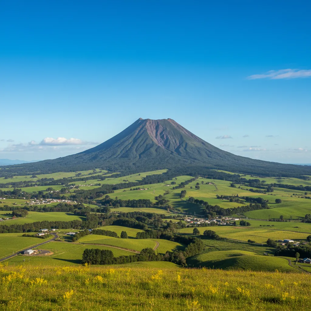
As you approach Kawerau, you will turn right off SH30 onto SH34 (Kawerau Road). The landscape changes dramatically from native bush to orderly pine plantations and the imposing industrial silhouette of the Tasman Mill.
Navigating the Town
Kawerau is designed with a unique layout. The town was planned in the 1950s, featuring curved streets and ample green spaces. The speed limit drops to 50km/h strictly as you enter the boundary. Be mindful that the entrance to the town often has police patrols checking speed as drivers transition from the 100km/h open road.
Kawerau as a Base Camp
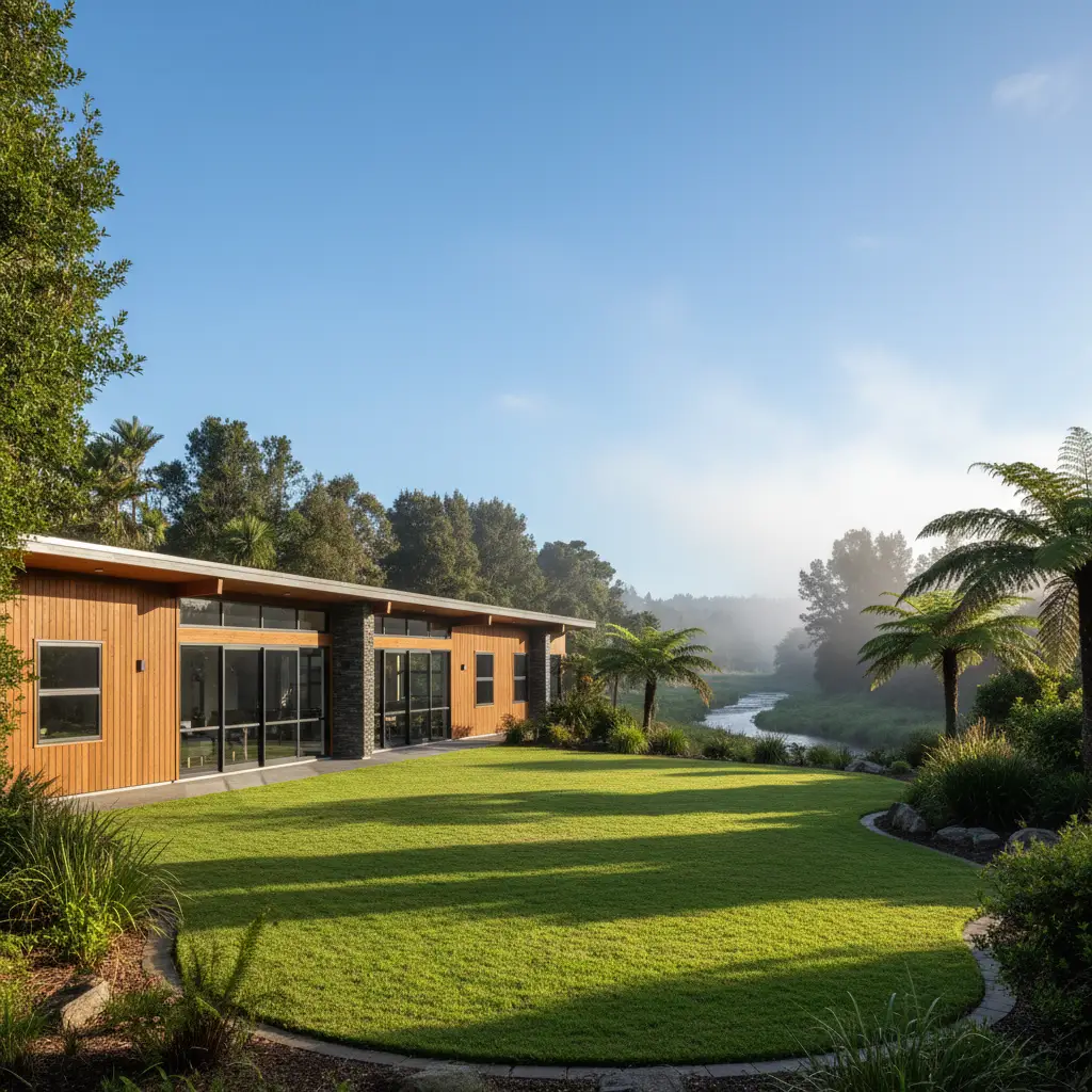
Smart travelers are increasingly using Kawerau as a “Base Camp” for the Eastern Bay of Plenty. Unlike the higher accommodation prices in Rotorua or Whakatāne, Kawerau offers a central location. From here, you are only 25 minutes from the coast (Thornton Beach), 45 minutes from Rotorua, and on the doorstep of the Tarawera Falls.
When you arrive, head towards the Firmin Field area if you are looking for the Tarawera River access, or the town center for supplies. The signage is clear, directing visitors to major attractions like the free thermal foot pools and the Tarawera Falls permit center (Information Centre).
Final Safety Checklist for the Drive
Before departing Rotorua, run through this quick mental checklist to ensure a smooth trip:
- Tire Check: Are your tires inflated correctly? The winding corners of SH30 require good grip.
- Washer Fluid: Ensure your reservoir is full. Logging trucks can throw up mud and dust that obscures vision quickly.
- Time Management: Allow 60 minutes if you have a strict appointment in Kawerau to account for potential slow trucks on the hills.
- Headlights: Keep them on even during the day. It helps you be seen against the dark backdrop of the forest and by heavy machinery operators.
Driving from Rotorua to Kawerau is a short but visually rewarding journey. By respecting the road conditions and the industrial nature of the traffic, you can enjoy one of the North Island’s most efficient corridors connecting geothermal wonders with forestry heritage.
Is the road from Rotorua to Kawerau sealed?
Yes, the entire route along State Highway 30 and State Highway 34 is fully sealed (paved). It is a two-lane highway suitable for all vehicle types, including campervans and motorcycles.
Are there many logging trucks on the road to Kawerau?
Yes, this route sees a high volume of heavy commercial traffic, particularly logging trucks heading to the mills in Kawerau and the Port of Tauranga. Drivers should exercise patience and only pass when safe passing lanes are available.
Can you see Tarawera Falls from the road?
No, you cannot see Tarawera Falls from the main highway. To visit the falls, you must drive to Kawerau, obtain a permit from the Information Centre, and drive a separate gravel forestry road to the falls carpark.
Is it safe to drive from Rotorua to Kawerau at night?
Yes, it is generally safe, but extra caution is required. The road is unlit for the majority of the journey, and wildlife (such as possums or wallabies) can be a hazard. Fog is also more common at night around the lakes.
How far is Kawerau from Whakatāne?
If you are continuing your journey, Kawerau is approximately 30 to 35 kilometers from Whakatāne, which takes about 25 to 30 minutes to drive via State Highway 30 or SH34/SH2.
Is there a bus from Rotorua to Kawerau?
Yes, the Baybus (Bay of Plenty Regional Council) operates a service (Route 104 or similar regional connectors) between Rotorua and Whakatāne which stops in Kawerau. However, schedules are limited compared to city services, so checking the timetable in advance is essential.