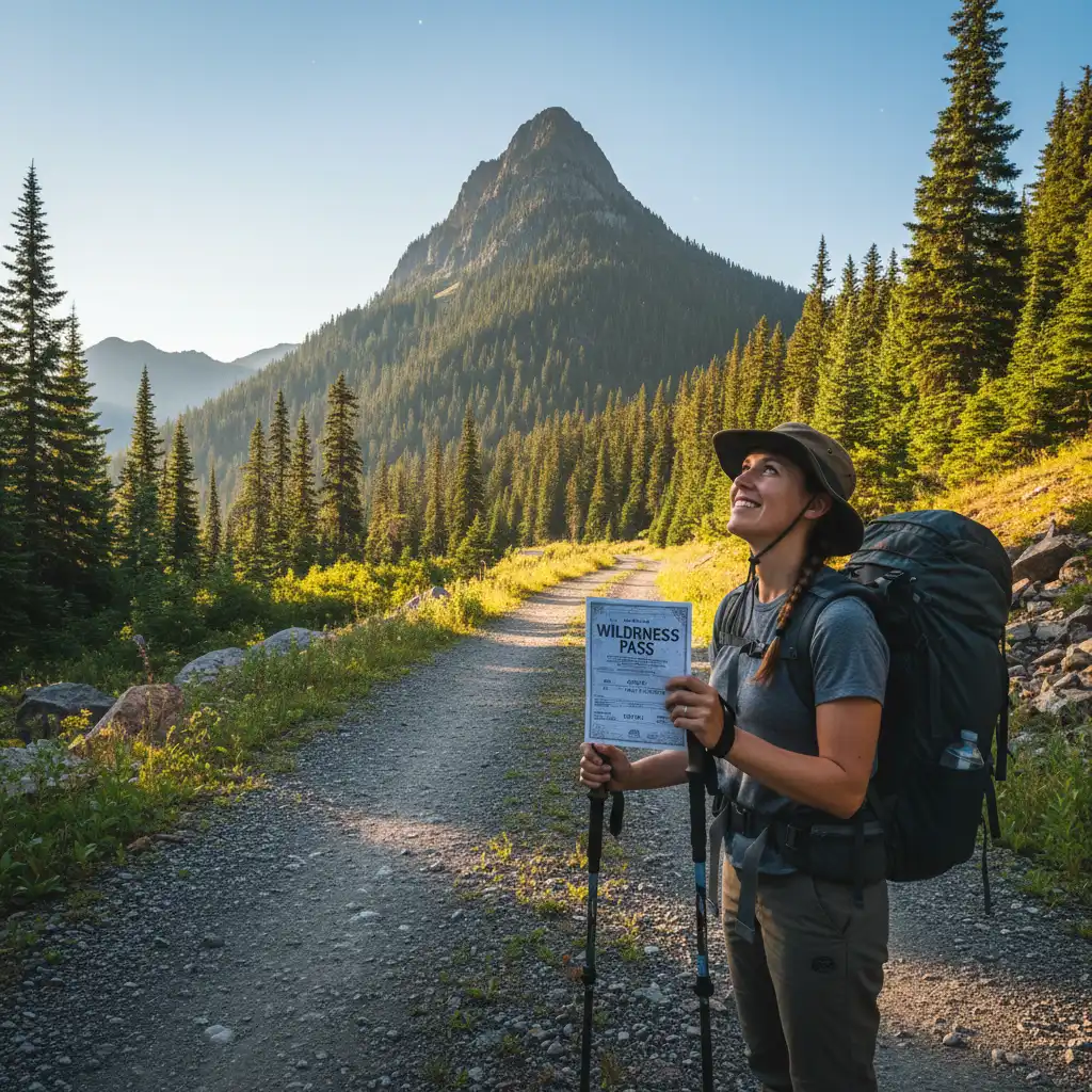
To climb Mt Edgecumbe Kawerau (Putauaki), hikers must first obtain a permit from the Māori Trust owners, as the mountain is situated on private land. The ascent is a challenging but rewarding experience, involving a steep hike up a gravel road and track that takes approximately 3 to 4 hours return, offering spectacular views of the Bay of Plenty.
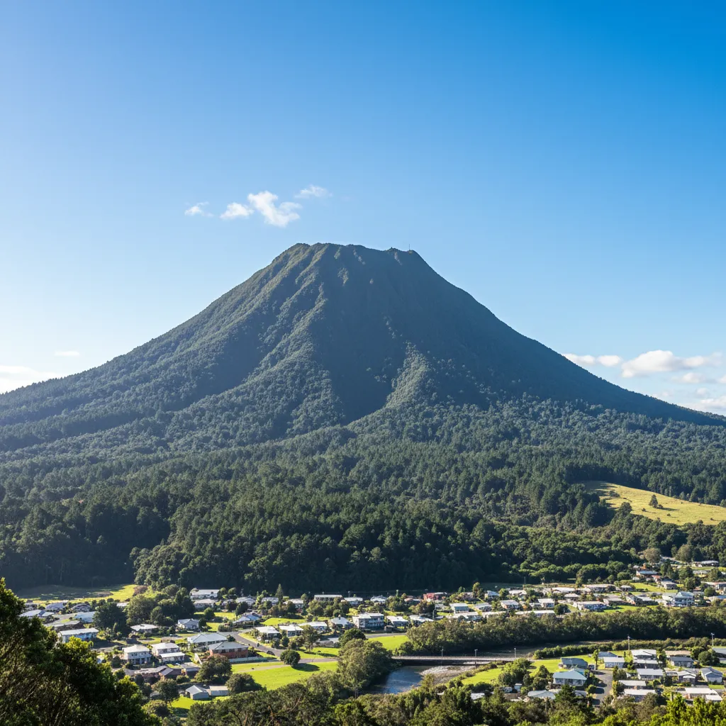
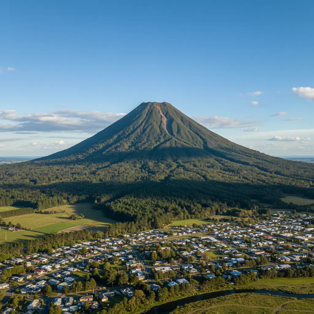
Rising majestically above the town of Kawerau in the Bay of Plenty, Putauaki (also known as Mt Edgecumbe) is more than just a volcanic cone; it is a geological landmark, a cultural taonga (treasure), and a formidable physical challenge. Standing at 820 meters high, this dormant volcano dominates the skyline, its perfect cone shape often drawing comparisons to Mt Taranaki or Mt Fuji.
For outdoor enthusiasts and those seeking to connect with the regional landscape of New Zealand, the hike offers unparalleled panoramic views stretching from the East Coast to Mt Tarawera. However, unlike public conservation lands, accessing Putauaki requires specific adherence to protocol, respect for private ownership, and a good level of physical fitness.
The Cultural Significance of Putauaki
To climb Mt Edgecumbe Kawerau is to step onto land that holds immense spiritual weight for the local Māori people, specifically the Ngāti Awa and Ngāti Tuwharetoa iwi. Understanding the legend behind the mountain is essential for any visitor wishing to show proper respect to the maunga (mountain).
The Legend of the Lonely Mountain
According to Māori mythology, Putauaki was not always located in the Bay of Plenty. In ancient times, he stood in the center of the North Island alongside the other great mountains: Tongariro, Ruapehu, and Ngāuruhoe. All the male mountains were in love with the beautiful Pihanga, a female mountain covered in lush green forests.
A fierce battle for Pihanga’s affection ensued. Tongariro emerged as the victor, winning the right to stand by her side. Defeated and heartbroken, Putauaki decided to leave the central plateau. He traveled north under the cover of darkness, carving out the path that would become the river valley. However, he was caught by the rising sun before he could reach the ocean, freezing him in his current location near Kawerau. He stands there today, forever looking back toward his lost love, Pihanga, and his rivals in the south.
Tapu and Respect
Because of this history and the presence of wāhi tapu (sacred sites) on the mountain, including burial caves in the crater, the mountain is treated with extreme reverence. The summit area, particularly the crater lakes, is considered sacred. Hikers are strictly advised to stay on the marked track and not to enter the crater or disturb any sites. The requirement for permits is not merely a bureaucratic hurdle; it is a mechanism to ensure that the mana (prestige/authority) of the mountain is upheld and that visitors acknowledge they are guests on private, ancestral land.
How to Obtain Permission and Permits
One of the most critical aspects of planning to climb Mt Edgecumbe Kawerau is securing the necessary access rights. Unlike Department of Conservation (DOC) tracks, Putauaki is privately owned by the Māori Trust.
Where to Get a Permit
Access to the mountain is controlled, and unauthorized entry is considered trespassing. Permits are generally available from the Maurie Kjar Memorial Swimming Pool or the Kawerau i-SITE Visitor Information Centre (located at Firmin Lodge or the town center, depending on current operations). It is highly recommended to call the Kawerau i-SITE in advance to confirm the current location for permit collection and the status of the track.
Key Permit Rules:
- Cost: There is typically a nominal administrative fee for the permit, which goes toward the maintenance of the access road and track.
- Timing: Access is usually restricted to daylight hours (often 6:00 AM to 6:00 PM in summer).
- No Dogs: To protect livestock and native wildlife, dogs are strictly prohibited.
- Vehicles: While the permit allows you to walk, keys for the vehicle gate are generally not provided to the public. Most hikers must walk from the base.
Route Description: What to Expect on the Climb
The journey to the summit of Putauaki is a tale of two halves: the approach and the ascent. The track is well-defined but physically demanding due to the relentless gradient.
The Lower Section: The Access Road
The hike begins at the designated car park near Firmin Lodge. From here, you will pass through the locked gate and begin walking up the 4WD access road. This section is gravel and winds its way through pine forestry and native regeneration. While not technically difficult, the road is a steady, continuous uphill slog that serves as a significant warm-up.
Depending on your pace, the road section can take anywhere from 45 minutes to an hour. It is wide and easy to follow, but in the height of summer, it can be exposed and hot. Hikers should be wary of occasional maintenance vehicles that may be using the road to access the transmission towers at the summit.
The Upper Section: The Summit Track
As you gain elevation, the vegetation changes, becoming dominated by hardier sub-alpine scrub and native bush. The road eventually gives way to a steeper, rougher track as you near the summit cone. This is where the true “climb” begins. The terrain becomes steeper, and footing can be loose in places.
The Summit and Views
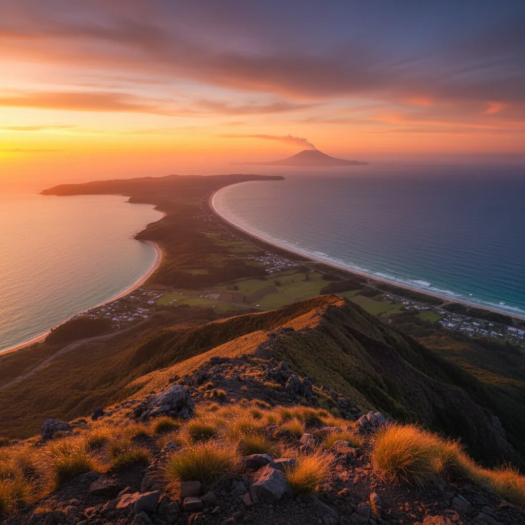
Upon reaching the summit (820m), the reward is immediate and breathtaking. The summit houses several telecommunications masts, but looking past the infrastructure, you are greeted with a 360-degree view that is arguably the best in the Bay of Plenty.
- North: The view stretches out to the coast, where you can see Moutohora (Whale Island) and, on a clear day, the active volcano Whakaari (White Island) steaming in the distance.
- South: You can see back towards the central plateau, spotting Mt Tarawera and the lakes of the Rotorua district.
- The Crater: Looking down into the main crater, you will see two small lakes. These are tapu; do not descend into the crater to touch the water.
Fitness Requirements and Preparation
Do not underestimate the physical exertion required to climb Mt Edgecumbe Kawerau. While it is not a technical alpine climb requiring ropes or crampons, it is a steep endurance test.
Who Should Attempt This Hike?
This hike is classified as Intermediate to Advanced purely based on the gradient. It is suitable for people with a moderate to high level of cardiovascular fitness.
- Distance: Approximately 7-8km return (depending on exactly where the gate is locked).
- Elevation Gain: You will be climbing roughly 600 to 700 meters in elevation from the base.
- Time: Allow 3 to 4 hours for the return trip. Fast walkers may do it in 2.5 hours, but those wanting to enjoy the view should budget more time.
If you have knee issues, be cautious. The descent is just as steep as the ascent and can be punishing on the joints. Trekking poles are highly recommended for stability and to reduce impact on the knees during the way down.
The King of the Mountain Race History
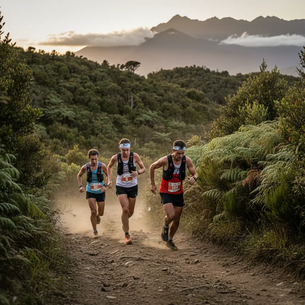
Putauaki is the home of one of New Zealand’s toughest and most prestigious mountain races: the Kawerau King of the Mountain. First held in 1955, this event has become legendary in the local community and the wider trail-running scene.
The Challenge
The race is a brutal sprint to the summit and back down. Unlike recreational hikers who take hours, competitors in the race complete the course in defyingly fast times. The race route is slightly different from the public walking track in sections, taking a more direct (and steeper) line up the face of the mountain.
The title “King of the Mountain” is fiercely contested. The course record stands at just under 46 minutes for the return trip—a feat that seems impossible to the average hiker who spends nearly that long just getting to the halfway point. The race is usually held annually and includes a “Prince and Princess of the Mountain” race for children, fostering a love for the maunga in the younger generation.
Safety Protocols and Essential Gear
Even though Putauaki is close to town, it is an exposed alpine environment at the summit. Weather conditions can change rapidly.
Essential Gear List
- Water: There is no potable water on the mountain. Bring at least 1.5 to 2 liters per person. It can get incredibly hot on the exposed gravel road.
- Footwear: Sturdy hiking boots or trail shoes with good grip are essential. The gravel can be slippery on the descent.
- Layers: Even if it is sunny in Kawerau, the summit can be windy and cold. Bring a windbreaker or light fleece.
- Sun Protection: The track is largely exposed to the sun. High SPF sunscreen, a hat, and sunglasses are mandatory in summer.
- Communications: Cell phone coverage is generally good due to the towers at the summit, but do not rely on it 100%. Tell someone your plans before you go.
By preparing adequately and respecting the cultural protocols of the land, climbing Mt Edgecumbe Kawerau becomes a memorable highlight of any trip to the Bay of Plenty. It stands as a testament to the geological power of New Zealand and the enduring spirit of the people of Kawerau.
Frequently Asked Questions
How long does it take to climb Mt Edgecumbe?
For an average hiker, the return trip takes between 3 to 4 hours. This includes time for breaks and enjoying the view at the summit. Extremely fit individuals may complete it in 2 hours, while a leisurely pace could stretch to 5 hours.
Is the Mt Edgecumbe track open to the public?
The track is on private Māori land. It is open to the public only if you obtain a permit from the designated locations in Kawerau (usually the i-SITE or swimming pool) and adhere to the access rules.
Can I drive to the top of Mt Edgecumbe?
No, public vehicles are not permitted to drive to the summit. There is a locked gate at the base. Only maintenance vehicles and authorized personnel have vehicle access. Hikers must walk from the car park.
Is the hike difficult?
Yes, it is considered a moderate to hard hike due to the steep gradient. It involves a continuous uphill climb on a gravel road followed by a track. A reasonable level of cardio fitness is required.
Are dogs allowed on Mt Edgecumbe?
No, dogs are strictly prohibited on the mountain. This rule is in place to protect livestock grazing on the lower slopes and the native wildlife inhabiting the bush.
What is the best time of year to climb?
The mountain can be climbed year-round, but Spring and Autumn offer the most comfortable temperatures. Summer can be very hot due to the exposed nature of the track, and Winter can be slippery and cold at the summit.